State USNG Maps
Currently, Minnesota is the only the state that provides a comprehensive series of USNG maps that cover the entire state.
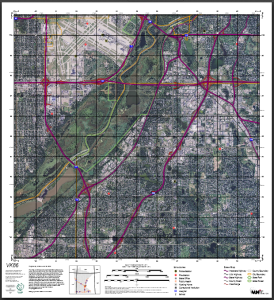
The Minnesota USNG map series, provided by MnGeo, are based on and show the USNG system and include the location of schools, hospitals, fire and police stations, roads and political boundaries over an air photo background.
- Find, view, and download USNG maps via an interactive map
- Go to FTP directory of map files (you will need to know the grid area you need)
Click on the image below to see an example map Minnesota USNG Map (PDF).
- Click on map to see example map