USNG Data Downloads
USNG data are available in GIS Shapefile format from the National Geospatial-Intelligence Agency (NGA) and from other providers including SharedGeo and the USNG National Implementation Center (TUNIC) at Delta State University.
Download USNG data organized by FEMA region or individual state below.
Download by FEMA Region
Click on a FEMA region in the map or use the links in the table below to access data download pages.
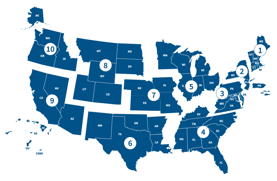
| Region | States Serving | Download Data |
|---|---|---|
| Region I | CT, MA, ME, NH, RI, VT | Data for Region I |
| Region II | NJ, NY, PR, USVI | Data for Region II |
| Region III | DC, DE, MD, PA, VA, WV | Data for Region III |
| Region IV | AL, FL, GA, KY, MS, NC, SC, TN | Data for Region IV |
| Region V | IL, IN, MI, MN, OH, WI | Data for Region V |
| Region VI | AR, LA, NM, OK, TX | Data for Region VI |
| Region VII | IA, KS, MO, NE | Data for Region VII |
| Region VIII | CO, MT, ND, SD, UT, WY | Data for Region VIII |
| Region IX | AZ, CA, HI, NV, GU, CNMI, RMI, FM | Data for Region IX |
| Region X | AK, ID, OR, WA | Data for Region X |
Data by State (100m)
In spring 2020, SharedGeo generated 100-meter USNG shapefiles for each CONUS state and Washington D.C. Each ZIP file includes shape files for every 100km grid zone that intersects the state. Due to overlap with adjacent states, some duplicate shapefiles may occur if multiple states are downloaded.
States:
Massachusetts
Michigan
Minnesota
Mississippi
Missouri
Montana
Nebraska
Nevada
New Hampshire
New Jersey
Districts and Territories: