Viewers
When not in possession of USNG standardized printed map product, one of the most difficult things to do is to take a USNG coordinate and quickly produce a basic, readable map, or visa versa: take a basic map or address and obtain a USNG coordinate.
Web maps and web services that include USNG coordinates links are provided below.
ArcGIS Online USNG Map
 |
Esri Inc., offers an the USNG in ArcGIS Online. ArcGIS Online allows for creation of custom maps by combining geographic layers posted by Esri, many other organizations and individuals. ArcGIS Online also allows users to upload their own GIS data and quickly create a map that can be shared and/or embedded on a website.See the ArcGIS Online USNG Map |
Florida Incident Mapper
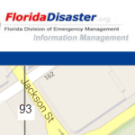 |
Not just for Florida, this mapping viewer shows USNG Zones, 100k and 1k grid lines and USNG coordinates that update as you scroll over the map. Go to the Florida Incident Mapper. |
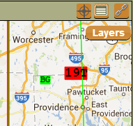
GISsurfer
 |
With long time interest in the USNG coordinate system and online mapping, GISsurfer uses a variety of base maps to deliver a simple, yet robust user interface. Easy to jump right in and start using: GISsurfer. |
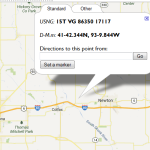
Google Maps Mashup (old API)
|
Back in 2007, Larry Moore saw a need to incorporate USNG coordinates into Google Maps and subsequently developed a USNG web map based on the Google Maps API. Long the only show in town, Larry opted not to upgrade the mashup when the Google API it was built on was retired in November 2013. However, background on the viewer and a link to an Open Street Map version built on OpenLayers remain available here: Google Maps USNG Mashup (old API). See immediately below for information on a Google replacement version. |
Google Maps Mashup Project (new API)
 |
SharedGeo is working on a USNG Mashup Project to upgrade Larry Moore’s original work to the latest version of the Google Maps API, including some basic enhancements that will add usability. As funds allow, SharedGeo plans similar capabilities in Bing Maps. Go to the Google Maps Mashup Project (new API) |
Mission Manager
 |
The Mission Manager system is designed to be very easy for anyone who understands missions to operate. The system is designed around the standard SAR Incident Command System (ICS) forms and will automatically generate these forms as you enter data. The system is designed to help you manage the mission from initial callout to finish. USNG coordinates and grid can be toggled on in the map. There is a simple “Getting Started” page, or simply go straight to the Mission Manager Map. |
Open Street Map (OSM) Mashup
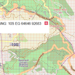 |
Created as an Open Layers map demo, there is a mashup that shows USNG coordinates with an Open Street Map (OSM) Basemap.Go to the Open Street Map (OSM) Mashup |