
Software
Find here USNG friendly software, programs and utilities that communities, response organizations, businesses and individuals can use to implement technology solutions that will facilitate use of the U.S. National Grid.
Computer Aided Dispatch (CAD)
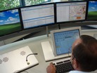 |
TicketsCAD – It’s absolutely free, supports USNG implementation, and best of all, it’s written by long time Federal communications expert Arnie Shore and his merry band of programmers. For more information, click here. To go to the project site to download, click here. |
Common Operating Picture (COP)
 |
Marconi – Written by Xavier Irias of the East Bay Municipal Utility District, Marconi is a free online program with a host of features that make it competitive with big bucks commercial COP platforms. A solid solution for utility and industrial emergency management scenarios that understand what USNG can do for response. For more information: click here, to go to the project site to and obtain an account: click here. (For full appreciation of this program, be sure to click “Enable advanced menus” on the Login page). |
HAZMAT
 |
MARPLOT – As the mapping piece of the CAMEO suite of products promoted by the Environmental Protection Agency (EPA) for HAZMAT response efforts, MARPLOT is free geospatial software created and maintained jointly by the EPA and the National Oceanic and Atmospheric Administration. For more information, click here. To learn how to add U.S. National Grid capability to MARPLOT, click here. To download MARPLOT, click here. |
Map Production
 |
Center for Interdisciplinary Geospatial Information Technologies – Home to The USNG National Implementation Center (TUNIC) at Delta State University, Cleveland, MS, find below Director Talbot Brooks‘ instructions for integrating USNG functionality into ArcGIS 9.3.1:
|
 |
Esri – Since fall of 2010, the world’s leading purveyor of mapping software, Esri, has had an extension available for its ArcGIS product which makes USNG integration relatively simple. Additionally, Esri’s U.S. National Grid Tools for ArcGIS are now shipped as a standard part of the Esri ArcGIS software package. For more information, click here. |
Map Viewing (Online)
 |
GeoMOOSE – Brain child of Bob Basques, Jim Klassen and Dan Little while working for the City of St. Paul, Minnesota, this Free and Open Source Software for Geospatial (FOSS4G) product was recently sanctioned by the world-wide Open Source Geospatial Foundation. Easy to install software that enables your local maps and imagery to be shared online with others. Currently used by hundreds of units of government around the world. It’s free and USNG functionality works right out of the box. For more information: click here. |
Search and Rescue (SAR)
 |
Mission Manager – A product of Michael Bailey, long-time, cutting-edge programmer and former Search and Rescue (SAR) Reserve Deputy Sheriff in Southern, California. Works with all major browsers, smartphones, and iPads, and can be used with the DARPA developed SARApp. Originally free, it became a charge for use product in summer 2014. For more information or to buy an account: click here. |
Esri and the Esri Logo are licensed trademarks of Environmental Systems Research Institute, Inc.